New and Old Hydraulic Societies in Sonora
Tom Barry
Like other states in the Transborder West, population
growth and economic development and modernization are products of hydraulic
manipulations. Damming, diverting, and drilling have turned the Sonoran Desert –
which covers nearly 40% of the state -- into a green belt for agribusiness and
the state’s urban core.
But the achievements of Sonora’s hydraulic
society have depleted water basins, turned rivers into dusty riverbeds, and
precipitated a rash of social, political, and economic conflicts.
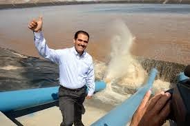
To keep Sonora developing and to satisfying the
ever-increasing demands for more water, Governor Guillermo Padrés Elías in 2010
created a new executive branch agency called Sonora SI (Integrated Systems) to supervise
the launching new hydraulic projects. With federal funding from Conagua
(National Water Commission), Sonora SI promises to complete 24 water projects, including
new dams, irrigation canals, deep water wells, and aqueducts.
The goal of the first Sonora SI water
megaproject – the Independencia or Novillo-Hermosillo aqueduct – was to solve
the acute water shortages in Hermosillo, which is the state’s capital and the
home of nearly one-third of the state’s population.
Hermosillo residents, construction companies,
industries, and agribusiness resoundingly approved of the new aqueduct, which
reached the city in late 2013. However, in the lower Yaqui River basin the
traditional and current beneficiaries greeted the proposal to transfer water
from the Yaqui River with an angry “No.”
The Yaquis soon became the militant vanguard of
the “No al Novillo” coalition opposing the construction and operation of the
aqueduct. The focus of the anti-aqueduct coalition was the transfer of 75 million
cubic meters (75 Mm3) of water from the Yaqui River Basin to the
badly depleted Sonora River Basin.
The Yaqui water war has also raised questions
about the sustainability of Sonora’s hydraulic society -- and about the political
viability of new plans to further manipulate the state’s increasingly scarce
water supplies.
Gov. Padrés at aqueduct pumping station on Novillo Reservoir / Periódico Digital
____________________________________________________________________________________________________________
Sonora Water Facts
·
Sonora has 27 major or
mid-sized dams – 18 of which are located in the Yaqui River basin, with four on
the Concepción River, three on the Sonora River, and two on the Mayo River.
·
There
are six water basins associated with six rivers: Río Sonoita, Río Concepción,
Río Sonora, Río Mátape, Río Yaqui y Río
Mayo.
· Annual precipitation: 427 milímetros (national average is 772 mm).
· Fifth driest state (following Baja California
Sur, Baja California Norte, Coahuila, and Chihuahua).
· Average annual surface water flows were 5,459
million cubic meters but total annual demand was 5,500 Mm3 –
constituting a deficit of 41 Mm3 in 2005.
· Irrigation systems allow the farming of
653,000 hectares of Sonoran arid and semi-arid territory – of which 63% depend
on surface water flows and 27% on wells.
___________________________________________________________________________________________________________
Source:
Análisis sobre el uso y manejo de los recursos hidráulicos en el estado
fronterizo de Sonora, Comisión Estatal del Agua, 2005.
Bavispe River below La Angostura / Tom Barry
Natural and Unnatural Flows
Water flows along the earth’s surface and down
arroyos, streams, and rivers into ponds, lakes, and seas. A small percentage of
the earth’s precipitation seeps into earth, accumulating over the millennia in
aquifers and large water basins.
In the Sonoran Desert and other arid lands, only
during extraordinary and extended rain events does the water that falls from
heavens penetrate the desert’s crust.
Low annual precipitation rates – 4 to 14 inches, depending on which area
– don’t fully explain why Sonora has so little water.
Because the desert is so hot and sun-drenched,
the high rates of potential evaporation and plant transpiration generally
exceed precipitation rates – which is essentially the definition a desert.[1]
In other words, most of the water that
falls on the Sonoran Desert neither flows nor seeps. Instead, precipitation
returns to the skies in the form of vapor.
Without water, there is no life. That’s a truism
that echoes throughout the arid lands of the Transborder West. In any
conversation about scarce water resources in the Chihuahuan or Sonoran Deserts,
there is some participant who invariably observes: “Aqua es vida” -- or some
English or Spanish variation of this experienced wisdom.
Before the current era of fuel and electric
pumps, most human settlements were found next to or near natural sources of
water. Yet, because of the fluid quality of water, human settlements and
civilizations have extended their geographic reach by channeling water from
distant rivers, lakes, and springs. Canals and aqueducts made life possible in
some of the world’s most arid zones by creating reliable supplies of water for
irrigation and domestic consumption.
Most ancient civilizations depended on water
engineering or hydraulics. Even when communities lived near rivers, in arid
regions, river flows were not dependable, necessitating the construction of
aqueducts that brought water to population centers from higher elevations.
Such was the case, for example, for the Paquimé
culture, which reached its height in the 15th century shortly before
the Spanish arrived. Situated near the headwaters of the Casas Grandes River in
what is now Chihuahua, the society could not have survived without a network of
gravity-fed channels and reservoirs transferring water from the eastern slopes
of the Sierra Madre Occidental into the center of the Paquimé society. These
channels and cisterns remain today as evidence of the ingenuity of the Paquimé
culture.
In Sonora, some indigenous communities (notably
Opata and Pima Bajo) had river-fed irrigation system. Others (Yaquis and Mayos) relied solely on
floodplain farming before the Spanish Conquest. Begging in the first half the
17th century, the Jesuit missionaries set about improving and
extending indigenous irrigation practices, which, along with Jesuit-mandated
indigenous farm labor, greatly increased agricultural production.
By the late 1800s the hydraulics of commercial
agriculture in Sonora no longer depended on gravity alone. Pump-fed irrigation canals opened up new
agricultural frontiers, transferring river water to desert scrublands.
Still, there are natural limits imposed on
modern hydraulic systems. Energy-driven hydraulic systems, like those that fed
the network of canals in the foreign-owned irrigation districts of the Yaqui
Valley during the last two decades of the 19th century and first
four decades of the 20th century, were still limited by the
variations in river flows. During the autumn and spring dry seasons, there
simply wasn’t enough water flowing in the Yaqui River to transfer into the newly
cleared irrigation-dependent fields.
Foreign agribusiness companies such as the
Richardson Construction Company in the Yaqui Valley started pressuring the
Mexican government in the late 1800s and early 1900s to dam the Yaqui River. Only
by damming the river could the company realize its plans to extend irrigation
canals beyond the delta and throughout the entire semi-arid coastal plain.
Reacting to this pressure and animated by its
own modernization ambitions, the post-revolutionary Mexican government launched
an ambitious modernization program in the 1920s that included the planned
construction of an array of hydraulic infrastructure projects.
Mexico closely followed the development model
already well underway in the U.S. West.
Under the auspices of the U.S. Bureau
of Reclamation (the bureaucratic manifestation of the U.S. Reclamation Act of
1902), the U.S. government open the largely arid Western states to agricultural
and urban development by constructing dams, reservoirs, and long-distance irrigation
canals, thereby enabling the transfer of river water across the desert. The
rapidly growing hydraulic society of the U.S. West also served as Mexico’s
model for the subsidized electrification of the desert cities and irrigation
districts of Sonora and elsewhere.
During the administration of President Plutarco
Elías Calles (1924-28), the government promulgated the Ley de Irrigación con
Aguas Federales (Federal Water Law) that committed the federal government to
develop major irrigation projects based on federally constructed dams,
irrigation canals, and hydroelectric plants. In 1926 President Elías Calles
established the National Irrigation Commission to implement this agricultural
development and modernization plan.[2]
Post-revolutionary political turmoil delayed the
construction of the planned hydraulic infrastructure. Not until the presidency
of Lázaro Cárdenas (1934-1940) did Mexico have the stability and political
leadership necessary to embark on program of economic nationalism and
modernization. In 1936 President Cárdenas, closely following the early
proposals of the Richardson Construction Company, ordered the construction of
Sonora’s first dam.
Modeled after the Boulder (Hoover) Dam on the
Colorado River, the federal government with U.S. financing completed La
Angostura dam and reservoir in the upper Yaqui River basin in 1942. Baptized
the Lázaro Cárdenas dam, Sonora’s first water megaproject blocked the natural
flow of Bavispe River – the largest northern tributary of the Yaqui River – as
it entered the narrow canyon known as La Angostura.
Carrying within its banks more than two-thirds
of Sonora’s surface water, the Yaqui River Basin extends south from the river’s
headwaters in southeastern Arizona to the coastal plains in southwestern
Sonora. Blocking the natural flow of the river, the new dam and reservoir
controlled the release of river water, thereby enabling irrigation in the Yaqui
Valley even during the dry months.
___________________________________________________________________________________________________________
Yaqui River Basin Facts
·
Carrying within its banks
more than two-thirds of Sonora’s surface water, the Yaqui River Basin extends
south from the river’s headwaters in southeastern Arizona to the coastal plains
in southwestern Sonora.
·
By far the largest (encompassing 71,452
km2 and healthiest in Sonora, with annual river flows from
tributaries and river averaging 2,852 Mm3 (measured mid-basin at the
Novillo / Álvaro Obregón dam).
·
Yaqui River basin accounts for 69% of
all the surface water in Conagua’s Noroeste region (covering virtually all of
Sonora and a bit of northwest Chihuahua).
·
Yaqui RIver dams/reservoirs: Lázaro
Cárdenas (La Angostura); Álvaro Obregón (El Novillo); and Plutarco Elías Calles
(Oviáchic), finished, respectively, in 1942, 1952, and 1965.
·
There is no public registry of water
users and water rights in the basin, pointing the failure of the federal and
state governments to formulate plans for the sustainable use of its waters.
·
Principal water users of basin water in
order of usage: Yaqui Valley Irrigation District (41), Ciudad Obregón, Grupo de
México (La Caridad mine), Colonias Yaqui Irrigation District (018), and small
farmers and ranchers who live along the upper and middle basins. Another major
·
No official or unofficial assessment
exists of the quantity of groundwater in the lower Yaqui River basin, although
damming the river dried up the delta and virtually ended the recharge of the
valley’s aquifers by the river.
·
Nor is there any comprehensive assessment of the quality of
groundwater in the Yaqui Valley, although tests of water wells do reveal severe
contamination (mostly by agrochemicals).
____________________________________________________________________________________________________________
The federal government assumed control of the Richardson
Construction Company (CCR) and its network of irrigation canals, while also
redistributing private and public lands into collectively owned ejidos
throughout the Yaqui Valley and giving the Yaqui people ownership of some
425,000 acres in the Yaqui Valley and in the Mátape Valley to the north.
The Richardson Brothers and other agribusiness investors in
the Yaqui Valley had long recognized that only by damming the flow of the Yaqui
River could their farming enterprises count on regular flows of water.
La Angostura, which was completed in 1942, was the first of
three major dams on the Yaqui River. Soon after its completion, the farmers of
the Yaqui Valley Irrigation District were clamoring for a larger dam that would
be built at the start of the lower Yaqui River basin.
To further control flooding during major rain events and to
ensure an even more dependable supply of irrigation water for the Yaqui Valley,
two other larger dams were later constructed: El Novillo and El Oviáchic, the
former 145 kilometers to west of Hermosillo and the latter 35 kilometers
northeast of Cd. Obregón.
With El Novillo and Oviáchic dams in place by 1962, it
became readily apparent that La Angostura, the first and the smallest of these
water megaprojects, had become redundant – although the copper mine in Nacozari
had become dependent on water from the reservoir. Although three dams were
built with hydroelectric plants, only the generating plant at the El Novillo
dam still regularly generates electricity.
Sonora’s Largest Reservoirs
Conversion: 1 hm3 =
1000000 m3
|
Name
|
Known As
|
Capacity
|
Year
|
River
|
|
Lázaro Cárdenas
|
La Angostura
|
864 h3
|
1942
|
Yaqui
|
|
Plutarco Elías Calles
|
El Novillo
|
2,963 h3
|
1963
|
Yaqui
|
|
Álvaro Obregón
|
El Oviáchic
|
2983 h3
|
1952
|
Yaqui
|
|
Adolfo Ruíz Cortinez
|
Mocúzari
|
1,114 h3
|
1955
|
Mayo
|
|
Abelardo Rodríguez
|
|
220 h3
|
1949
|
Sonora
|
|
|
|
|
|
|
|
Source: Conagua, “Principales Presas,” 2012, at:
http://www.conagua.gob.mx/atlas/usosdelagua33.html
Cynthia Hewitt de Alcántara, one of the most
respected analysts of Mexico’s agricultural sector, described in her history of
Mexican agriculture how Sonora, largely owing the creation of hydraulic society
starting in the 1940s, became known as the “Mesopotamia of Mexico” and the
“Agricultural Cornucopia of Mexico.”[3]
Since
the early 1940s Sonora’s demographic and agricultural boom has been largely the
product of hydraulic manipulation. Despite its aridness, Sonora is Mexico’s
second largest agricultural producer -- virtually all the result of irrigation.
By the 1960s, one-fourth of federal spending for
irrigation infrastructure had gone to Sonora. As a result, irrigated land in
Sonora nearly doubled in two decades.[4]
Eleven percent Sonora’s land is irrigated, making it the state with
highest percent of its agricultural land served by irrigation systems.[5]
No
other state in Mexico has been so dramatically transformed by the federal
government’s network of dams, aqueducts, and irrigation canals. Agriculture
accounts for 92.3% of water consumption in Sonora,[6]
and no other Mexican state is intensively irrigated as Sonora. Virtually
all this agriculture occurs in the arid western plains and along the coast,
where average annual rainfall is 4-15 inches, depending on the part of the state
– with the most precipitation in the Sierra Madre Occidental and the least in
the Altar Desert in northwest Sonora.
Novillo Dam/ panaramico. com
Solving Water Shortages with More
Hydraulic Megaprojects
Throughout Mexico, government entities – at the
local, state, and federal levels – have again been calling for new water
megaprojects to address the country’s acute water shortages. Sonora – the state
that disproportionately benefited from Mexico’s hydraulic infrastructure
projects – is leading the way to a new hydraulic future with its Sonora SI
(Sistema Integral) program.
Elected in July 2009, Governor Padrés can
rightly claim to be leading Sonora’s hydraulic renovation. Shortly after he
received the governor’s sash and moved into the Palacio del Gobierno, Padrés
declared that he would create “Un Nuevo Sonora” during his six-year term (sexenio).
With its plan for 22 hydraulic megaprojects, Sonora SI is the designated
flagship program of the governor’s “Nuevo Sonora.”
As the
Sonoran government -- with more than two-thirds financing from the federal
government -- continues with its water megaproject program, there is little
reflection of the failures and consequences of Sonora’s “hydraulic society.”
Instead
most of those involved in the water wars in Sonora -- with the exception of
small circles of environmentalists and academics -- look to inter-state and
intra-state aqueducts, along with proposed desalinization plants to solve the
intensifying water crisis.
Both
sides of the Yaqui water war, for example, support an unimplemented federal
plan for an aqueduct that would bring water from the Nayarit and southern
Sinaloa (two water-rich states along the Pacific coast) to Sonora. The Northwest Hydraulic Plan (PHLINO) would
be a mega-megaproject that would transfer water to the Sonoran Desert and the
semi-arid region of northern Sinaloa – areas that receive 5-20% of the
precipitation that falls in the tropical state of Nayarit. [7]
In
pointing to the PHLINO inter-state aqueduct as the ultimate solution to
Sonora’s water crisis, proponents ignore concerns by environmentalists that
such a massive inter-regional transfer of water would further diminish the
state’s already decimated rainforests.
Similarly,
despite the indigenous rights component of the Yaqui water war, calls for the
PHLINO have not considered the opinions of the Wixárika (Huichol) and other
indigenous communities native to Sinaloa, whose land is under siege by
water-hungry mining companies.[8]
Yaqui governors voice their opposition to Independencia aqueduct / Tom Barry
The
anti-Independencia coalition, then, is not opposed to water megaprojects. They
just don’t want the megaprojects built for the Yaqui Valley to be tapped by
other interests.
The
valley’s agricultural sector, its agro-industries (including the highly
polluting chicken and pork sectors), and the wealth of Ciudad Obregón are the
products of Sonora’s first water megaprojects, including the network of irrigation canals dating from
the early 1900s, the three Yaqui River dams and reservoirs, and the large
irrigation canal – named in honor of Lázaro Cárdenas -- that channels water
from the Oviáchic reservoir directly to the Yaqui Valley.
Because
of these megaprojects, Sonora’s largest river no longer flows to the sea. The
river delta is a remnant of the pre-dam era, when the Yaqui River would flood
part of the valley. The valley’s groundwater basin is also a remnant of a time
when the river ran free.
As is,
the Yaquis receive very little of the water stored in any of the three
reservoirs on the Yaqui River. Virtually all the water that flows to the valley
through canals goes to agribusiness and to white or mestizo farmers who either own large extensions of valley land or
rent Yaqui land
Before
the government dammed the Yaqui River, the once mighty river reached the
coastal plain where the Yaquis live. Water seeped through the alluvium left in
the floodplains. Over the millennia, the delta created aquifers of fossil
water, recharged year after year as the river flowed to the sea.
Agribusinesses,
agro-industries, and the city of Obregón tap this groundwater, supplementing the
water supplies channeled from the Oviáchic reservoir. Persuaded by government
promises that Yaqui communities would receive potable water, the Yaquis agreed
in 1991 to allow the state government and Conagua to construct an aqueduct to transfer
this fossil water to the desert cities to the north.
A
battery of pumps feeds this Yaqui-Guaymas aqueduct that delivers water to
purification plants serving Guaymas, Empalme, and San Carlos. But the
government only partially complied with its promises to supply the Yaquis with
drinking water. In large part, this deception explains Yaqui opposition to yet
another
Shutting
down the Novillo-Hermosillo aqueduct wouldn’t mean that the Yaqui River start
flowing through the Yaqui Valley. Nor would it necessarily mean that Yaquis
would reclaim their heritage as farmers. Turning off the flow of water to
Hermosillo wouldn’t help recharge the shrinking and now badly contaminated
aquifers of the Yaqui delta region. A victory by the No al Novillo coalition
wouldn’t result in better access to drinking water for the Yaquis.
The
transfer of water from the Yaqui River basin to Hermosillo will, however, make
it still more difficult for the Yaquis to pursue their historic claims to water
from the Yaqui River. With as much as 75
Mm3 of Yaqui River water flowing annually to Hermosillo, the Yaquis
face yet another obstacle in pursuing demands that the federal government honor
the tribe’s water rights. The now vested interests of Hermosillo in having
access to the Yaqui River will likely prove much stronger than the historic
water rights of the Yaquis.
Hydraulic
megaprojects have reshaped and redefined Sonora. Without hydraulics, there
would be no New Sonora.
The
Yaqui Valley wouldn’t be Mexico’s breadbox, the population of Hermosillo would
not have tripled over the past three decades, Ford wouldn’t have opened a major
manufacturing plant in Hermosillo, San Carlos would not now be a booming
vacation spot, and the Nacozari copper mining operations would not have the
water it needed to expand on such a massive scale.
Yet,
from the beginning, modern hydraulic projects have had heavy costs and consequences. The dams and reservoirs on the Yaqui, Mayo,
and Sonora Rivers have each displaced hundreds of families. Most were subsistence
farmers with indigenous roots – few of whom were adequately compensated for
their losses. Reservoir water now covers many villages of the Old Sonora. [9]
Even
farmers who are able to remain in dammed river basins are adversely. As
reservoirs capture river water, not only do farmers suffer from reduced river
flows in many areas but they also see groundwater levels drop, forcing them
either to drill deeper or abandon their farms.
Among the dozens of Yaqui River
communities most affected by reduced access to surface and groundwater,
Granados and Huásabas stand out both because of the extent of their water
losses and because the State Water Commission and Conagua claimed in 2011 that
these farmers had sold their water rights, thereby increasing the amount of
unallocated river water and permitting the transfer of this water to Hermosillo
through the Independencia aqueduct.
The
environmental costs of Sonora’s hydraulics society have never been calculated,
just as the environmental impacts of Sonora SI’s new projects – dams,
aqueducts, reservoirs, and a proposed desalinization plant – have been glossed
over in declarations about role of these projects in purportedly solving the
Sonora’s deepening water crisis.[10]
[1] “The Sonora
Desert: Background Information,” Arizona-Sonora Desert Museum, 2007.
[2] Sterling Evans, “Damming
Sonora: An Environmental and Transnational History of Water, Agriculture, and
Society in Northwest Mexico,” Produced for Workshop in the History of
Agriculture and Environment, University of Georgia, March 25, 2011; Robert C.
West, Sonora Its Geographic Personality
(Austin: University of Texas, 1993).
[3]
Cynthia Hewitt de Alcántara, La modernización de la
agricultura mexicana, 1940-1970 (Mexico City: Siglo XXI, 1978)
[4] Cynthia Hewitt de
Alcántara, La modernización de la agricultura mexicana, 1940-1970
(Mexico City: Siglo XXI, 1978), p. 131; Cited in Evans, Damming Sonora,
p.6.
[5] Refugio I. Rochin,
“Mexico’s Agriculture Crisis: A Study of its Northern States,” Mexican
Studies 1, 1985, p. 257; Gary Paul Nabhan and Andrew R. Goldsmith, “State
of the Sonoran Desert Biome: Uniqueness, Biodiversity, Threats, and the
Adequacy of Protection in the Sonoran Bioregion, ” p. 34, cited by Evans, p. 6.
[6] Análisis
sobre el uso y manejo de los recursos hidráulicos en el estado fronterizo de
Sonora, Comisión Estatal de Agua (CEA), Octubre 2005.
[7] El Plan Hidrauico del Noroeste, Instituto Mexicano de Tecnología del Agua and
Semarnat, at:
https://www.imta.gob.mx/historico/instituto/historial-proyectoswrp/rd/2009/fi-rd0821-3.pdf
[8] “The Huichol (Wixárika) People’s fight against
multinational mining companies,” Geo-Mexico, Nov. 14, 2014, at:
http://geo-mexico.com/?p=12177
[9] In "Damming Sonora,” Evans recounts the
tragic case of the community of Casa de Teras community that was forcibly
relocated to the Yaqui Valley to make way for La Angostura reservoir. This
process of dislocation starting with La Angostura in the late 1930 was repeated
in the construction of the other major dams in the state into the early 1960s.
Even small dams like El Molinito (completed in 1991) on the Sonora River
displaced stable communities of small farmers and ejidatarios. See, for example: Rolando E. Díaz Caravantes and
Ernesto Camou Healy, “El agua e Sonora: tan cerca y tan lejos. Estudio de caso
del ejido Molino de Camou,” Región y
Sociedad, No. 34, 2005.
[10] Sustainability in the Yaqui Valley, A project of Center for Environmental Science and Policy,
Stanford Institute for International Studies, Stanford University, at: http://yaquivalley.stanford.edu/; Margaret Reeves, “Yaqui Fields of Poison,” PAN
North America, Summer 2006.